A Flinders research project has delivered a sea of data to measure our coastal environment and a number of ways to tackle environmental change in new and meaningful ways. It’s a story that started in Brazil, taking a detour in Louisiana, USA, before having an impact in Adelaide, South Australia.
Dr. Graziela Miot da Silva grew up on an island in southern Brazil. Her beach lifestyle threatened by pollution and the depleting ozone layer inspired her to pursue studies in oceanography. “When I started oceanography, I fell in love with coastal studies, dunes and beaches – both the geological side of oceanography and the physical side. I wanted to understand why the coast erodes and what can be done to minimize that.”
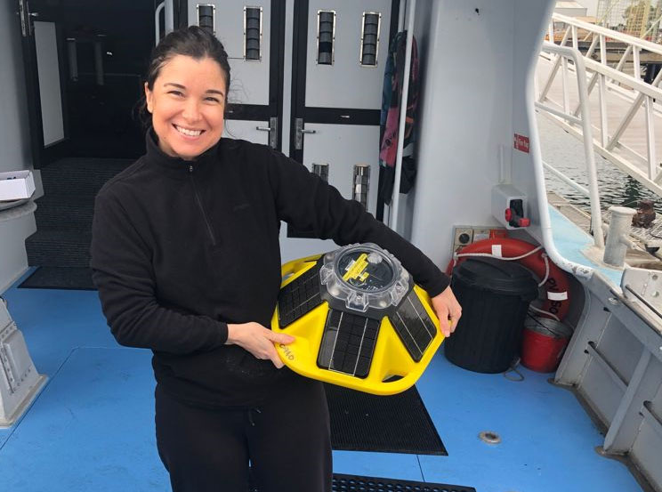
That passion led her to the Coastal Studies Institute at Louisiana State University – its proximity to the hurricane-prone Gulf of Mexico giving a sharp focus to the dangers the weather can have on the coastline. It was her experience using advanced data measuring through buoys, that stayed with her when she landed in South Australia to further pursue her career. “I thought, where was the data? Why is it that there was only the one of the Kangaroo Island and I thought, okay, this is an opportunity to make this happen here.”

Graziela’s drive led to a successful Department of Environment and Water grant application, allowing the purchase of more advanced (and cheaper, thanks to technology advances) buoys that deliver a range of data. There are currently three buoys in SA waters, positioned at Kangaroo Island (Investigator Strait), Brighton and Semaphore. This data not only aids research and can validate and inform current modelling but is also shared with a range of organisations and different industries to serve many purposes.
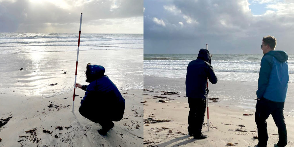
PhD student Ben Perry is using the data for his research analysing the impacts of the of the Adelaide metro shoreline’s response to waves. “I’ll be looking at erosion and accretion along the coast and considering sea level rise into the future so that we get an idea of how that amenity is going to change and what sort of management practices may need to be deployed in the future as well.”
Long term, the data collected will play an increasingly pivotal role in planning around sea-level rise.

“We learn more about water level and wave characteristics as well as informing predictions about flooding, inundation and erosion. That can help when we’re looking at these big infrastructure projects about how significant that hazard is going to be in the future.”
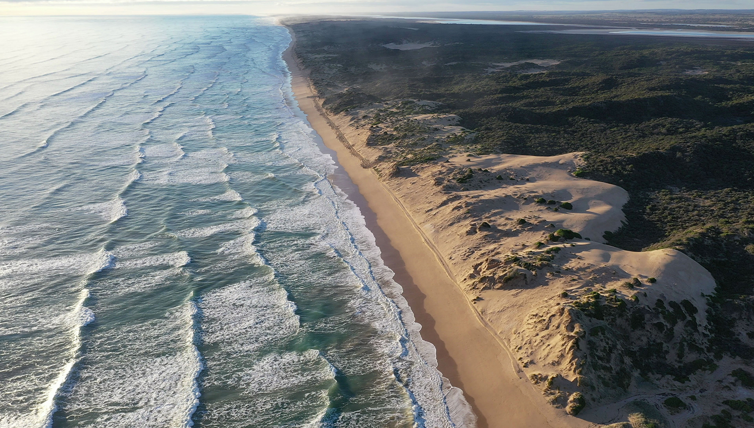
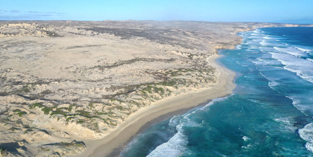
The data is also helping inform other research including Phd Candidate Marcio DaSilva’s study into coastal dunes and their response to disturbances, such as fire. “After the catastrophic fire (on Kangaroo Island), we began looking at what effects the fire would mean for the stabilization of those dunes. So we’ve been monitoring a couple of places within Flinders Chase, and along the coast and Kangaroo Island monitoring for that landscape stability effects of fires. Similarly, the other half of my PhD, is on coastal dune change that’s driven by waves and wind in the Coorong. This is around 42 Mile Crossing where we’re seeing rapid shoreline erosion.
“That’s driving the landward translation, or the moving back of these coastal dunes by wind, and this is occurring quite rapidly. So, meters in a year of shoreline disappearing and 10s of meters in a decade of moving this system inland.”
These projects will continue to develop and play a significant role in understanding the shape of our coastline as it continues to change, a process Marcio is prepared to be an evolving one. “That’s all ongoing research at the moment. And one of the big issues that we have is we don’t fully understand the wave side of things. And that’s what these guys (Graziela and Ben) are doing that brings a lot of value added to my understandings of what’s happening on land.”
The sympatico between projects is also acknowledged by Ben. “That’s where they kind of mesh together – the wave buoys provide physical measurements. The other way that we’re able to get real measured data is from remote sensing, which is what Marcio does with drones and satellite imagery. It adds to our suite of tools that can validate our predictions about coastal hazards.”

It’s not all data analysis, some of the most satisfying parts of the research involve feet-on-the-ground in some of South Australia’s most beautiful and remote locations. “I’ve been doing bimonthly surveys in Flinders Chase National Park. I spend a week at a time in Flinders Chase, conducting drone and vegetation surveys of in the fireground. We were able to stay in the national park in the heritage accommodation there,“ said Marcio.
“There’s a lot of logistics involved with getting out there. But once you’re out there, there’s no cell phone reception, there’s no internet, there’s nothing. You’re just out there in a wilderness trying to understand the effects of disturbances on these landscapes. It’s a great place to do fieldwork.”
A combination of work in the field, understanding new data and sharing discoveries, is bringing together our understanding of the coastline like never before. And the possibilities ahead are manyfold according to Marcio. “There’s a lot of applications that between us, we would like to do with if we had three more lives, but it’s really fulfilling to do at least what we can with the time we have.”
For Ben, the satisfaction of having meaningful impact in people’s lives is a real driver for his research. “There’s a whole bunch of different lenses you can look at the science we do through if you’re a surfer, if you’re a kayaker or if you like whale watching. And it’s often those interests that feed into the love of what you’re doing and makes you want to go to work every day.”
That’s something that resonates with Graziela, who’s journey started all the way back in Brazil. “It’s like a dream coming true to be able to develop this network of buoys and providing data for not only for us to use in our research, but for the community.”
*
Want to study at Flinders with Dr. Graziela Miot da Silva?
*

